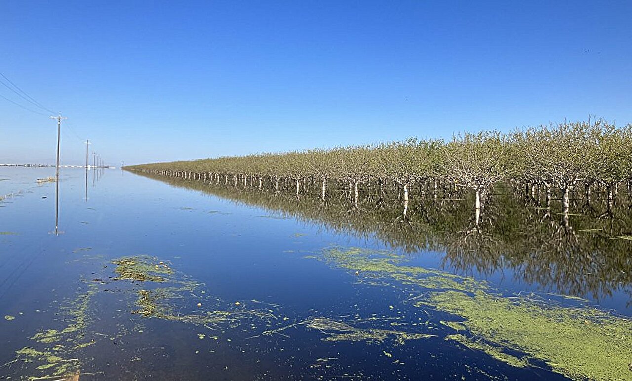
Missing lake returns

snowcraig2.0

Well-Known Member
Nov 2, 2007
11,133
7,812
113
47
Cedar Rapids, IA
Holy ****.

Once, Underhill says, there was so much water that a steamship could carry "agricultural supplies from the Bakersfield area up to Fresno and then up to San Francisco"—a distance of nearly 300 miles.
Very hard to envision.
 
This is a fascinating book about how California changed ‘Tulare Lake’ into Central Valley agricultural land. Truth is stranger than fiction. I picked this up in the neighborhood ‘little library’…glad I did. This lake was once the second largest lake in the USA.
 

Attachments

  • B5034410-CAAE-4313-AFA8-124E394B945A.jpeg
    B5034410-CAAE-4313-AFA8-124E394B945A.jpeg
    717.8 KB · Views: 72
  • Like
Reactions: ABECyguy
lived in tulare county. its a very unique area. hispanics, portuguese, and the dutch. great food. good people

culture-austin-powers.gif
 
All jokes aside this is equal parts a good thing for the habitat and a bad thing for your grocery bill. Having those native species of waterfowl back is a great thing but that part of California grows half of the fruits and vegetables we eat so supplies are going to be a problem.
 
  • Like
Reactions: khardbored
All jokes aside this is equal parts a good thing for the habitat and a bad thing for your grocery bill. Having those native species of waterfowl back is a great thing but that part of California grows half of the fruits and vegetables we eat so supplies are going to be a problem.
Actually produce growers in that region have been running at reduced capacity for several years due to imposed restrictions on irrigation water. So some net benefits if those are lifted.
 
At 29 palms Marien Corps base a lake of pretty good size shows up when it rains for a bit, then disappears after a while. Even when the lake is gone people say stuff like “down by the lake”
 
I'm going to start a petition to have it renamed 'Missing Lake'.
If it stays, that's a great name to confuse everyone.
If it dries up again, that's what will show up on Google Maps when someone looks at a satellite view of a bunch of dirt
 
Actually produce growers in that region have been running at reduced capacity for several years due to imposed restrictions on irrigation water. So some net benefits if those are lifted.
Hard to grow that stuff when it’s under water and you lost your home.
 
Publishing that article without a series of maps comparing the original lake, dried up lake, and current water levels should be a firable offense.
 

Help Support Us

Become a patron